This is what makes the range quite exciting: even though it’s less than three hours away from Manila, it gives the sense of wilderness that is not found in other nearby mountains.
-Gideon Lasco, Hiking matters #387: Mariveles Range (Pantingan Peak to Tarak Ridge) Traverse Part 2 – To Tarak Ridge
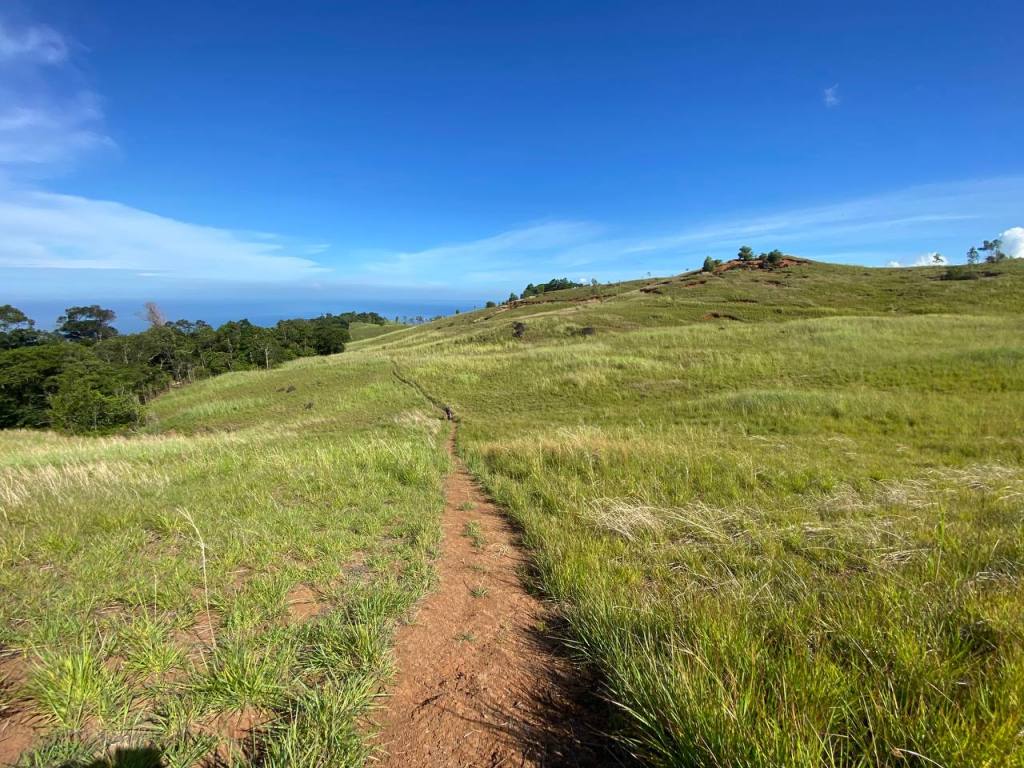
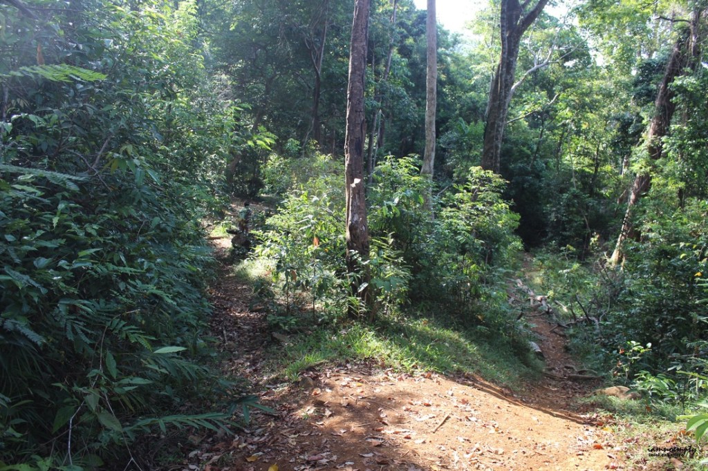
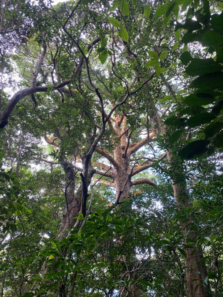
The beauty of Mt. Mariveles is that it will not bore you with repeated scenery, but rather, it will surprise you that for every terrain you pass, it changes; so too is the flaura and fauna living inside the forest. The only lacking in this mountain is pine trees.
The idea of hiking Pantingan came up when we hiked Bataan Peak last Holy Sunday, Aiko asked our guide Raswein if he could guide us to Pantingan Peak to Tarak Ridge Traverse. He agreed, and a month after, he accompanied us. We were supposed to be joined by another two people: Saf, another friend, and MJ a guide and Raswein’s friend. However, they backed out because of personal reasons. Raswein’s companion also did not come which lead to his bag became heavy.
We left Manila at 1 in the morning. When we alighted Genesis Bus to Alas-Asin at 4 in the morning, Raswein was standing there waiting for us. Afterwards, Aiko, and Karen ate their respective breakfast, and we then proceeded to Tarak Jumpoff to drop our extra clothes. Raswein hired a tricycle for our ride to Bagac, the jump-off point to Pantingan Peak. Warren, a guide in Tarak, told Raswein that we could use a porter to carry extra water. In retrospect, I regret not hiring Warren because of the trail along the way.
No public transportation was plying from Mariveles to Bagac, so commuting there was impossible. However, there was a route from Balanga to Bagac, but it would take longer than the chartered tricycle. At 7:17 AM, we started the hike.
The Salaysayin Trail was closed because the private owners decided to fenced the trail. So, Raswein trailblazed another trail which was shorter than the regular one. At 8:17 AM, we already arrived at Marlboro Peak. It had been called as such because it looked like the hills from a Marlboro advertisement back in the day.
We arrived at Danny’s Gate after an hour. The latter half of Pantingan Peak consisted of fallen trees because of illegal logging. Too bad, the trees looked more than decades old. And I wonder if the loggers acquired a DENR permit to cut trees.
Aiko told the group that she was thirsty. Unfortunately, we hadn’t refilled out water on the roadside eatery. Crap! Raswein forgot to to refill his water bottle. Oh boy, this would be a test of endurance.
Past 10 in the morning we arrived at the first camp. Raswein, and I tried to find water but to no avail since the ridge going down was full of overgrowth. We already drank our remaining water, without knowing that there were no water sources along the way. At 11 in the morning we arrived at Subuangan Campsite. The heat, dense jungle, and humidity slowed us down. We arrived at Pantingan Peak at 1:30 in the afternoon, slower than our supposed itinerary because of our hunger and thirst, as well as the heat and humidity.
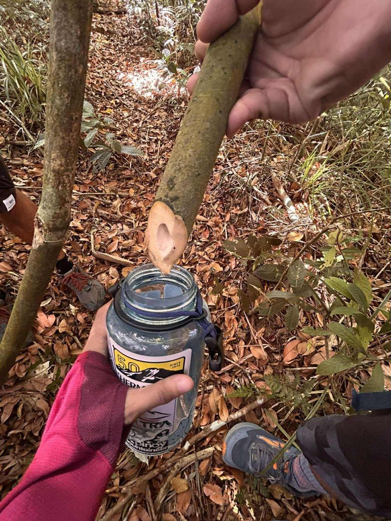
Aiko told the group that she was thirsty, so thirsty that her throat was dry. So Raswein, and I fetched some yantok/rattan so as to quench her thirst for the time being. The yantok yielded so small an amount of water that it could not quench your thirst. But hey, at least it will save you from severe dehydration. We continued to harvest yantok/rattan until Kilabot Peak. Anyway, we arrived at the trail in between Pantingan Peak, and Mag-Asawang Bato. The soil there was loose, so loose in fact that I stepped into the trail, I fell from the trail! Luckily though, I only feel 5 feet or less because if it was a ravine, I would definitely be part of kwento in Mt. Mariveles.
Raswein told us that Pantingan Peak used to be where locals hide during World War 2. It was not as overgrown as this one but rather established.
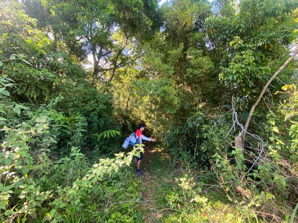
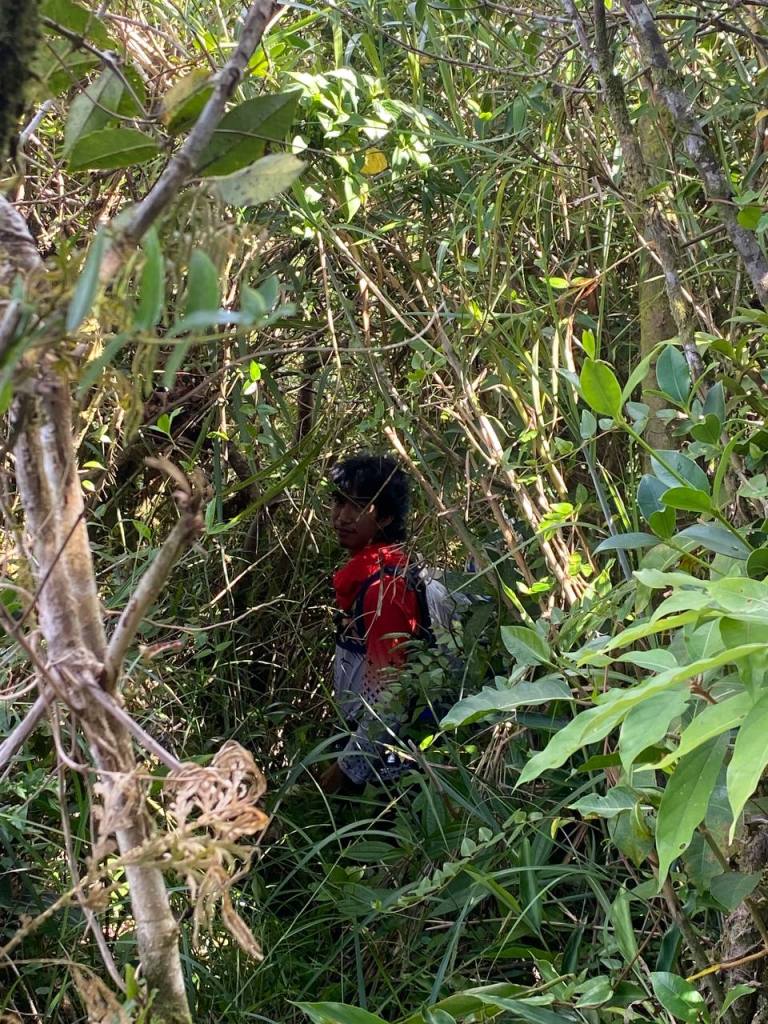
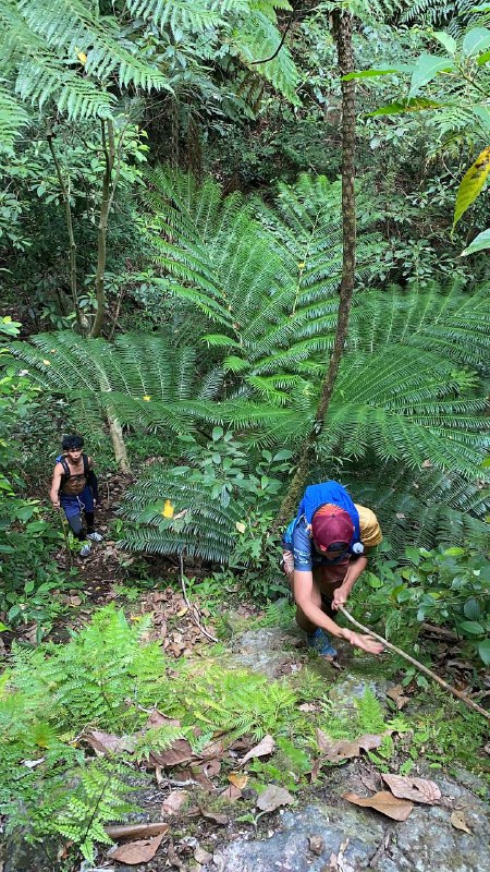
The trail all throughout the Mag-Asawang Bato to two peaks, that is, Garuchas, and Kilabot Peaks consisted of lush overgrowth, and thorny plants. You need to duck in order to reach the other side of the trail.
As I posted that picture in Reddit some people said to me that we should practice LNT. But I say fuck it, who are you to decide what we should do in that situation? Your self righteousness will lead to your death. I bet, you will be doing what we have done given our dire circumstance.
Our campsite was in Bakwat River so we rushed downwards. The 500m descent was the most dangerous part of the first day. Loose soil coupled with lush overgrowth would make you tumble down the cliff. And so we did. Hungry, tired, and dehydrated, we negotiated the trail. Raswein supported the two women, while he told me to go to the river. I did. But I got lost, night was fast approaching, and I was disoriented because of the dense forest.
Truly, Mt. Mariveles will expose you to the elements. I was scared, really scared for my teammates, and myself. I did not move once I knew I was lost. I waited for Raswein to meet me. Soon, the three, and I reunited. They told me they tumbled on the cliff. Raswein caught them, but his knee got hit on a rock. It was painful he said. But there was not time to waste because we were dehydrated. Aiko, and Karen stopped on a flat surface. They said they could go no longer because there was no water.
Raswein and I rushed towards the Bakwat River to fetch some water. The ground was precarious and we slipped downwards. I wished I brought my rope, I quipped. We finally arrived at the Bakwat River. We took gulps of water, then refilled my 2L water container and took upwards so that Aiko and Karen would drink. After 20 to 30 minutes we arrived at their spot. They took huge gulps of water; it seemed to refresh them; after five minutes or so, we descended to the ravine once again.
At 8:43 in the evening, ten hours more or less of no water, we arrived at Bakwat River! Finally! We could get to set our camp, rest, and drink lots of water! Despite the major delays in the planned itinerary, I would prioritize my safety of my teammates over the itinerary. The campsite was small, only one tent can accommodate the campsite. So hammocks are recommended if you’re going to do a full traverse since there are trees in the campsite. Bakwat River is also home to limatiks. This is a good sign that the river is pristine and clean.
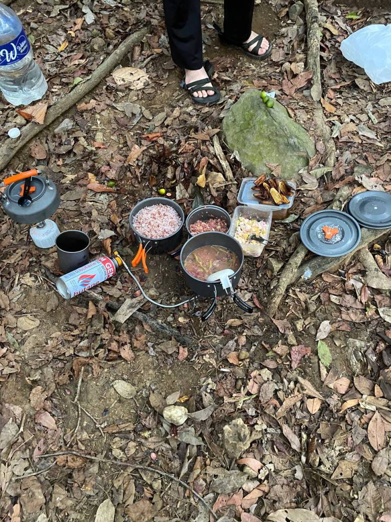
We set up out shelters, and Aiko was cooking. The meal was sumptuous albeit simple. That’s the beauty of hiking, even the most simple of meals will get delicious when you get tired! We decided to sleep at 11 in the evening. Raswein told us that we were lucky because Pantingan Peak was always raining.
We had short socials, talking about the hike earlier. I joked: What hafen Aiko, what hafen? I know, Pantingan, right?
However, before we slept we heard rumbling. Dark clouds were looming; and we saw thunder flashing in the deep, dark night. Rain would come, I said. The group prepared the tarps, getting ready for the downpour later. Luckily, during the night, only drizzle came.
I woke up at 5 in the morning the next day, having awoken by the loss of air in my inflatable mat, feeling the cold, damp forest floor. The air was crisp and cold. This is what I like about sleeping in the mountains: the solitude and the camaraderie of your teammates,
We ate our breakfast, broke camp, and left Bakwat River at 8:23 in the morning. We ascended to what it looked like the reverse of what we had descended last night, but this time we were recharged. As such, the ascend was pretty easy. The soil was loose, and the terrain was full of ravines, that one slip could let you tumbling down.
We finally reached the large rockface that I was dreaded when we conducted reconnaissance one week before the hike. Some of the team members hauled their bags upwards especially Karen who had a heavy backpack, while Aiko climbed the rockface using the yantok that acted as a rope, while her backpack was on her back. I was astonished by her steadfastness in keeping our training pure! Excellent job, Aiko!
That’s the end of the Pantingan Peak . We finally passed that dreadful ordeal. Now, we came to Paniquian.
Paniquian River was characterized by large boulders with a running river—- obviously! The soil was not as loose as in Pantingan, but one still must exercise caution in these parts. Caution because there were banakon (bakuneko, lol!) or king cobras that were bathing in the pools of the river.

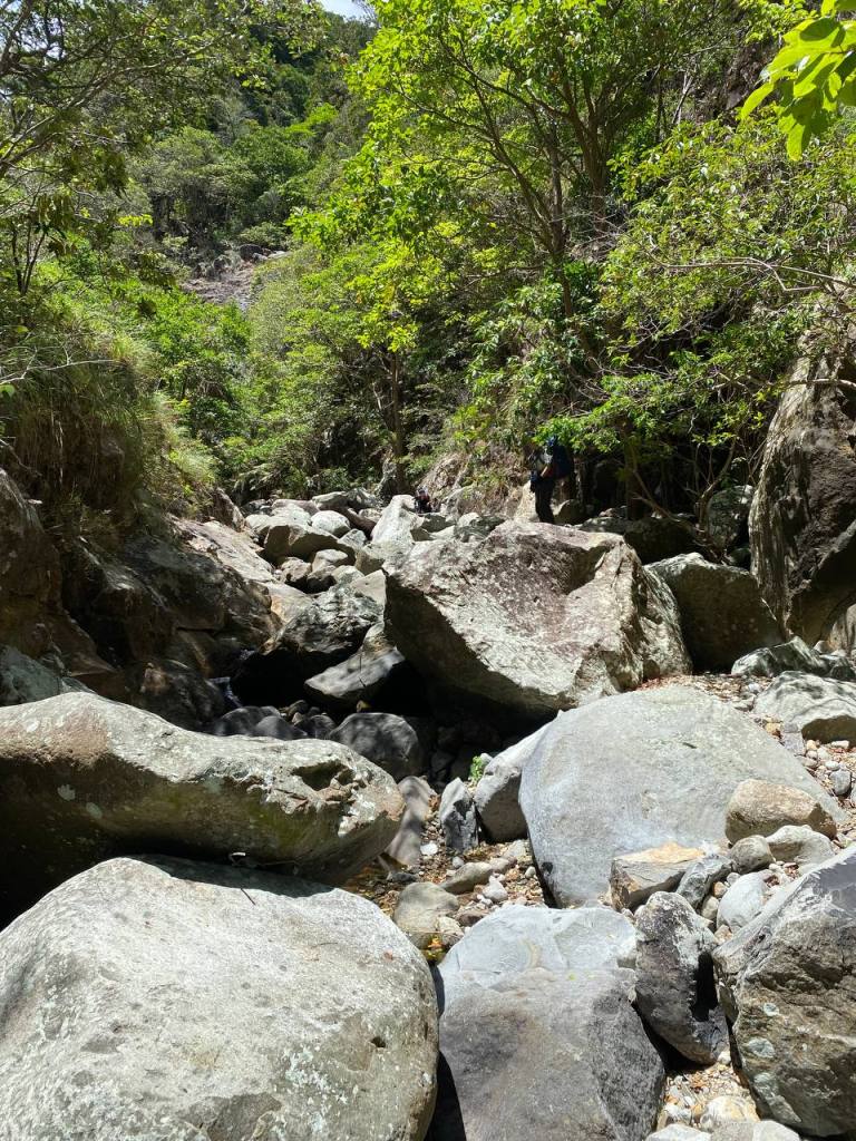
The fun part of this trail was that you got to hop in the boulders. And what’s more was that water was plenty albeit the weather was hot. Dehydration no more!
We took a break and boiled some water so as to drink Energen.
Aiko created a cake made from Fudgee Bar, and a leaf symbolizing a candle. We learned that her birth anniversary was week.
At 12:30 in the afternoon, we proceeded the hike. The proposed itinerary was that we would pass through Papica-Jerez Boulders. But for some reason, we proceeded to Cox’s Wall, and to Magellan Campsite. Cox’s Wall, was described as a steep 30 minute climb that you needed to hold to trees, which were luckily not dead, to gain foothold.
Magellan Campsite was a wide campsite near Tarak Peak. It was used by Ayala Mountaineers for their training hikes. We thought that there was no water source, so we thought that they needed to fetch water in Paniquian. Raswein disagreed. The water source in Magellan Campsite was near, he said.
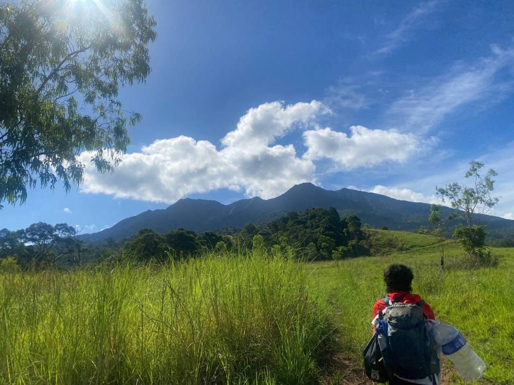
We then proceeded to the Japanese Garden. It was a trail characterized by loose slate like rocks, and aroma like plants, a type of thorny plant that you saw in a beach. Bataan Peak looming at the side of Mt. Mariveles
One of the hardest part of this climb was the climbing the large rocks near Tarak Peak. I could not imagine that I will do this on a rainy season!
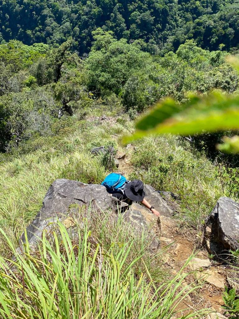
Aiko, and Karen had had difficulty in climbing these rocks. Aiko told us that she felt dizzy climbing it. When they did Tarak Ridge Circuit, going down these rocks were pretty easy. Nevertheless, they managed to climb through the large rocks.
After 7 hours of hiking, we finally reached Tarak Peak! At last, the hike was nearing its end! We took our pictures there.
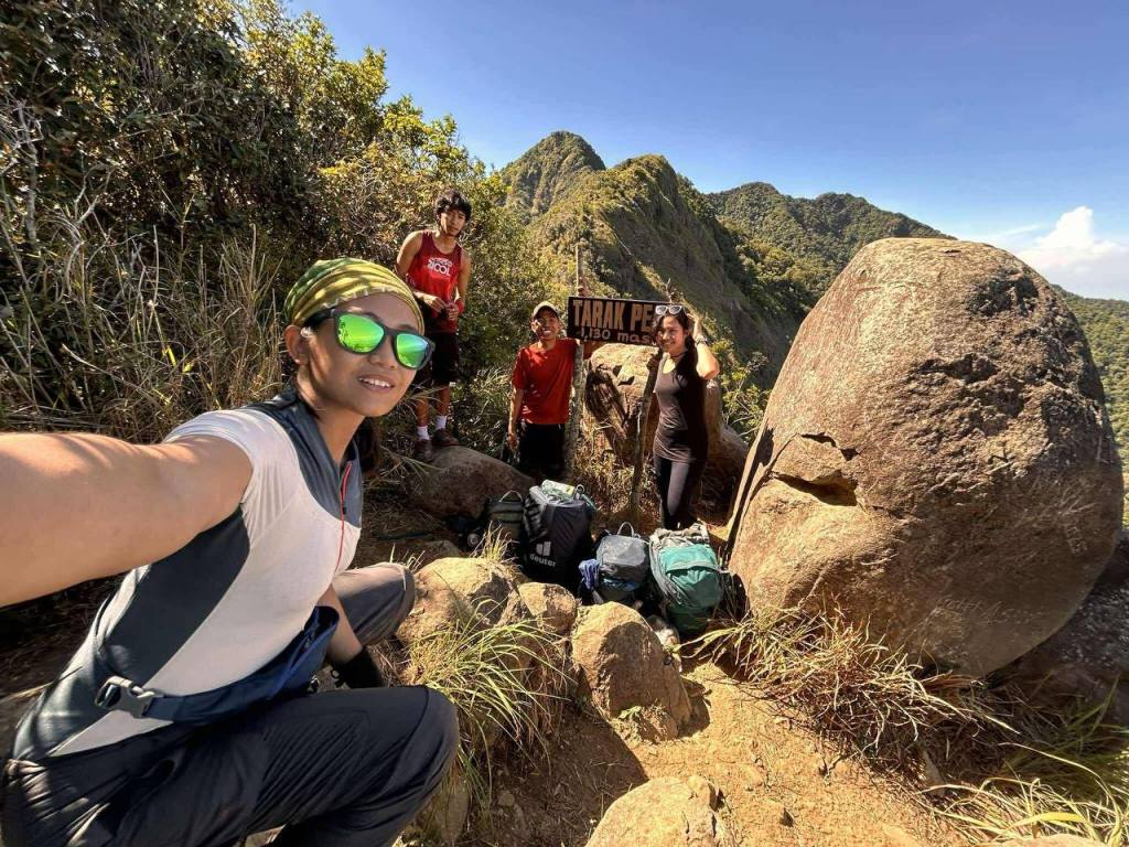
Karen, and I hiked Tarak last December 2024. However, the guide dissuaded us to go to the peak beacuse of the strong wind. Now, she finally got to the peak.
We decided to climb down the peak, and went to the second campsite: Papaya River. After two hours or so—- we were slow because we were already sure that we could get the campsite without much difficulty. And because Raswein’s bag wore him down. It seemed that he was not used to carrying heavy packs anymore.
We sensed that we were near the Papaya River because of campers and their bluetooth speakers roaring deep inside the jungle —- what irked me most. The worst part was that they were shouting as though they had been inside a bar. Methinks that they were not really hikers but casual campers. At 5 PM, all of the team arrived at the campsite. Aiko and Karen rejoiced that we reached Papaya River safe.
We started to reflect what happened to us the day after. Looking back, we thought that we would get seriously injured there.
After we cooked dinner which was tasty by the way, we slept. Raswein slept at 7PM! The accumulated tiredness crept unto him, while the rest of the group slept at around 8:30 in the evening.
The last day came, and we cooked what we called Victory Meal, victory because we past that ordeal of a traverse.
While fetching water from Papaya River, I saw a familiar face. He wore a long red sleeved shirt, shorts, backpack, and worn out Crocs. It was MJ! I was glad to see him! He accompanied some day hikers to Tarak Ridge. We talked for a while before parting our ways.
The hike from Papaya River to Tarak Jump Off Point took us 2 hours, because we walk relaxingly, knowing that the trail was well established, and we got to taste the fruits on the trail.
When we arrived at the Jump Off Point, Ate Beth, the lead guide, who was preparing jackfruit for the turon, told me that she could not imagine hiking Pantingan Peak with a full pack. If hiking it with a running vest was hard, what more could a full pack do?
Completing the group, we decided to take a shower so that we could get to the bus early. Having the bags ready, we boarded the rented tricycle and bid Raswein goodbye. At 5 in the afternoon, we reached Manila. What a hike! I know that this hike will be hard, but I haven’t expected to be THAT HARD.
Life consisted not only on happiness but also on suffering. Denying one means denying life itself. So too is hiking. Shared misery and suffering will lead you to shared joy and happiness.
There folks was the end of our hike. Now for the lessons I have learned in this hike:
- Always prepare up to the most minute detail. Life of your teammates depends on adequate preparation
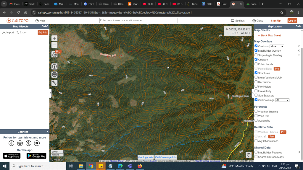
- Always prepare a hard copy of your map with you. Use CalTopo to set-up your route.
- Always bring an extra water with you, despite the weight it would cost,
- Avoid attachments outside your bag. It will be awkward, and the tendency is your balance will be compromised.
- In that kind of terrain like Mt. Mariveles, pack light.
- Mental resiliency is one of your best gear out there.
- There is silver lining to everything even it it looks bleak.
Itinerary
Day 1 ( Dehydration and Disorientation Overload)
7:18 start trek
8:47 arrived at Danny’s Gate
10:00 arrived at Camp 1
11:00: arrived at Subuangan Campsite
16:30 arrived at Pantingan Peak
17:30 arrived at Mag Asawang Bago
15:30 arrived at Garuchas Peak
17:00 arrived at Kilabot Peak
19:13 arrived at Bakwat River
20:43 All of the members arrived at Bakwat Campsite
23:00 rest
Day 2
6;00 wake up
8:20 start trek
9:00 arrived at Bakwat River
10:20 arrived at Paniquian River
11:30 lunch
16;00 Magellan Campsite
17:10 Japanese Garden
14:45 Tarak Peak
15:00 going down
17:00 arrived at Papaya River
19:30 rest
Day 3
5:00 woke up
5:30 fetch water
6:00 cook
8:00 start trek
10:50 arrived at jump off point
12:07 ETD Alas-Asin
5:00 ETA Manila
