PCT 2 is the second phase of Yabag’s Thru Hike. Though it is considered as Phase 2, it is considered as the last phase of the thru hike, because of the trail length, and difficulty of it. Imagine, being self contained for 5 days. Your bag will be definitely heavy because of the food.
On the eastern side of the Philippines, the Pacific Coast trail Phase 2 stretches from Dingalan to Baler, Aurora. Back then, the trail length was 94 KM long. However, because of the recent developments made it the area, that is, the once a hilly side of the Sierra Madres turned into concrete roads that traversing to the neighboring towns. Though the road is for the benefit of the locals, I could not help but think of the hills that are permanently change because of the road, the once wild and lush areas are now lost because of development.
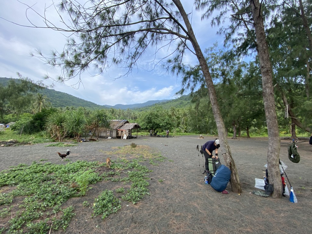
We alighted the bus after five hours of travel time. Then we stopped over a local karinderia to eat, and buy supplies. After we ate, we hopped on into a coaster. Actually, we did not expect that we would ride a coaster because last year, they rode a hog truck going to the jump-off point.
In PCT 2, Yabag also had had a challenge to participants. Last year, the challenge was no bath for five days, I now quite disgusting, lol!
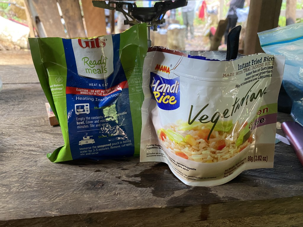
This year, purely self-contained, no resupply, and no requesting of supplies from other participants. There were four participants this year: Joep, Pagz, Aiko, and me. In retrospect, I am not sure if I can fully self-contained the entire five days, because the morning meals are not enough for the five days of hiking. The prize was P2,000 pesos, a bag from Mammut, Delimondo Corned Beef, and 7 Summit Hats, care of Miguel Mapalad, and Jeno Panganiban, the ones who summited Everest recently.
Anyway, the coaster traversed so many a hills that turned into concrete roads. The roads in this case was littered with rocks, and small streams that came into the mountain, for rainy season had come in the Philippines. Mang Boyet told us after the hike it was formerly a part of PCT 2. However, they discontinued traversing it because a road had been made.
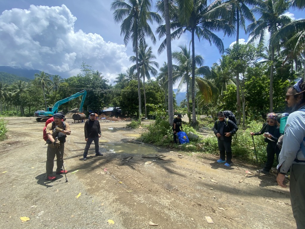
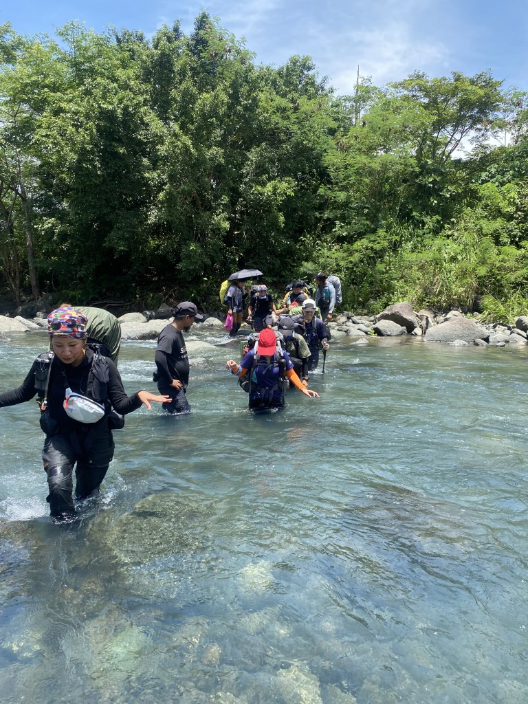
40 minutes or an hour had passed, we were at the jump-off point. As all in the PCTs, we traversed a hip-deep azure river. It was cold but refreshing, a break in all the sweltering heat that day. All the participants crossed the river, and after a couple of minutes rest, we resumed the trek.
Being part of the Sierra Madre Mountain Range, the Aurora Mountains is lush with life. It is also always wet despite the season.
In our case unfortunately, we are trekking in a hot, humid environment because it was midday. You could feel the sweat trickling on your body, despite the thick foilage of the forest. Not to mention the muddy forest floor which made the hike more difficult, for you could not get a proper foothold especially on uphill. We rested after we get to 150 MASL. From here, the campsite was near as Rexxa told us.
When the participants were completed we resumed the hike. We passed an open area where the plants overgrown. I could see a lot of fallen trees. It was made of the buying craze of land in Dingalan. Many people invested in land especially on the hills. That’s why there were fallen trees on the trail. The reality here was saddening, since the buyers were ignorant in the consequences of what they are doing.
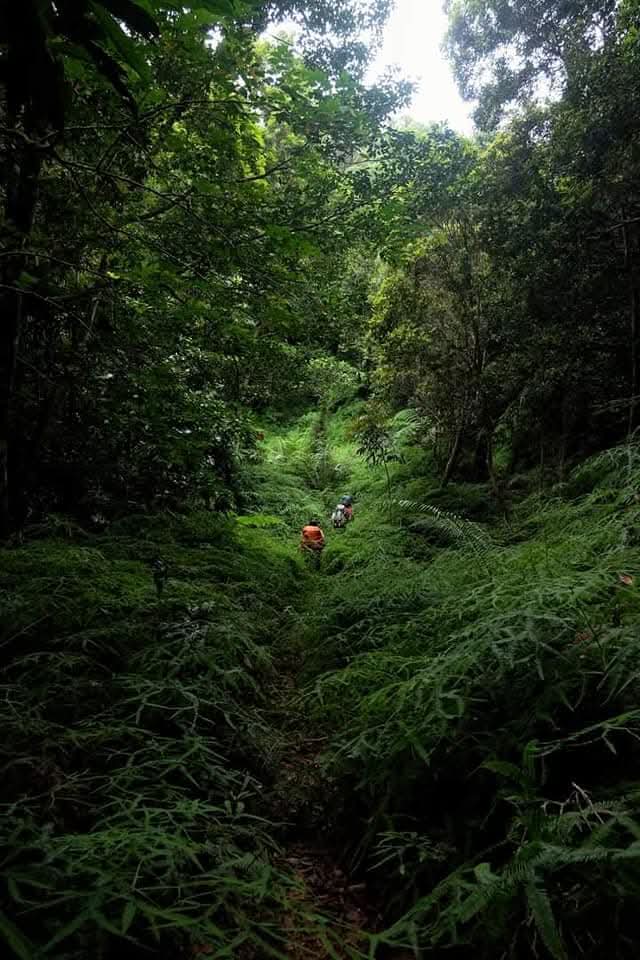
There were a lush trail full of ferns. However, only half remained, and it was almost denuded.
We rested to the once fern trail so that the sweeper group catch up. Meanwhile, Rexxa offered an egg cracker to me, but RJ shouted that it was forbidden to take trail food from someone. Heeding his warning, I did not take her egg cracker. When the sweeper group arrived, we resumed our trek; the denuded forest continued up to one hour until we reached Dikapingisan, Dingalan.
During the pre-climb, Mang Boyet told us that there was a hut in the campsite. We turned out that it was a house built for the caretaker of the land.
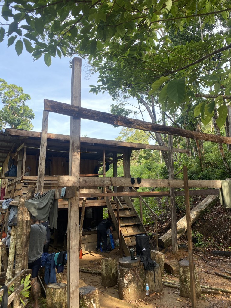
Luckily, there was a water source here connected by a black pipe, a pipe that is rife in the mountains in the Philippines. We set up our sleep system and ate our lunch here. We slept near the eating area, while the women slept on the room upstairs, and the others outside setting up their tents and hammocks.
Meanwhile, RJ set-up his stove, and kettle boiling water for his coffee. I, on the other hand, sat beside him and prepared my lunch/dinner. When his water boiled, RJ beckoned anyone to get a cup of boiling water. Heeding his call, I got his kettle and pour water into my cup to make some coffee. RJ saw what I did, and he shouted you could not do that!
I pondered over his warning, and thought if I discarded this coffee, it would be a waste of water, and coffee. So I drank it; I was disqualfied from the challenge! Only three remained from the challenge. They seemed to be determined to win methinks.
There was a silver lining to that, however: I could get a shot of gin from the other participants. So after we ate, we drank a little to help get sleep in the cold weather. Past 8 o’clock in the evening, I slept.
This day was short, only four hours so that we could prepare for the hardest trek on PCT 2: day 2.
Second day came, and everyone was awake. The sun arises above early, after a hard rain last night; the fog wafted in the air as though a smoke that disappears on the air. Mang Boyet called to start the trek at 8 o’clock in the morning. Everyone packed their bags, tighten the straps, and hoisted them at their back. For documentation, the group took a group picture before the start of the trek.
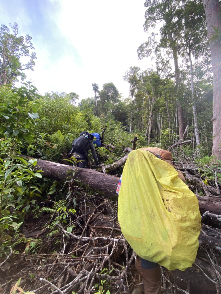
The start of Day 2 was on the right side of the hut; the trail was littered with overgrown plants, and fallen trees, and because it rained last night, the trail became slippery, for you had to have to cross across the logs in order to go to the trail. Your hands must be free from what you are holding because you needed to to use them to traverse the fallen logs. The trail continued for one hour or so until we get into an actual foot trail. Mang Boyet told us this day was we got to traverse Hill 700.
Hill 700 is so called because of the actual elevation of that hill which is 700 MASL. It is the shoulder of Mt. Mingan, one of the tall mountains in the Sierra Madre and stands as the boundary between Nueva Ecija, and Aurora. It is a different kind of adventure in itself.
We thought that the footpath would lead to Hill 700. But we were so wrong! We bushwhacked through the thick foliage which were filled with ants. Should you find it on your legs, better to swat it away because its bite hurt! We past that foliage and we got into another trail. Mang Boyet told us on Day 4. However, because of said buying craze in Dingalan, someone made a trail, a god send to us, for bushwhacking is not necessary.
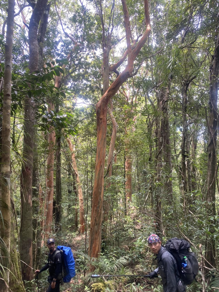
What made this trail unique is that it is full of trees having a color of its bark red. Its like a rainbow eucalyptus, a tree that is endemic in the Philippines . The tree is predominant in Hill 700. At 10 o’clock in the morning, we reached the summit of Hill 700. Its summit marker resembled of a pyramid shaped sticks, a shape that someone was ready to make some campfire.
We took our lunch on the summit, and rested for 30 minutes until we descended, heading towards the campsite.
Limatiks or forest leeches were present in the summit. This kind, however, was not as aggressive.as the ones you see in Mt. Irid; and the bulalangwan was not present. It is a green colored leech that loves to sneak into your orifices, and suck your blood there. Rather, the limatiks here were brown leeches, ones that suck your blood on your leg, and inside your socks.
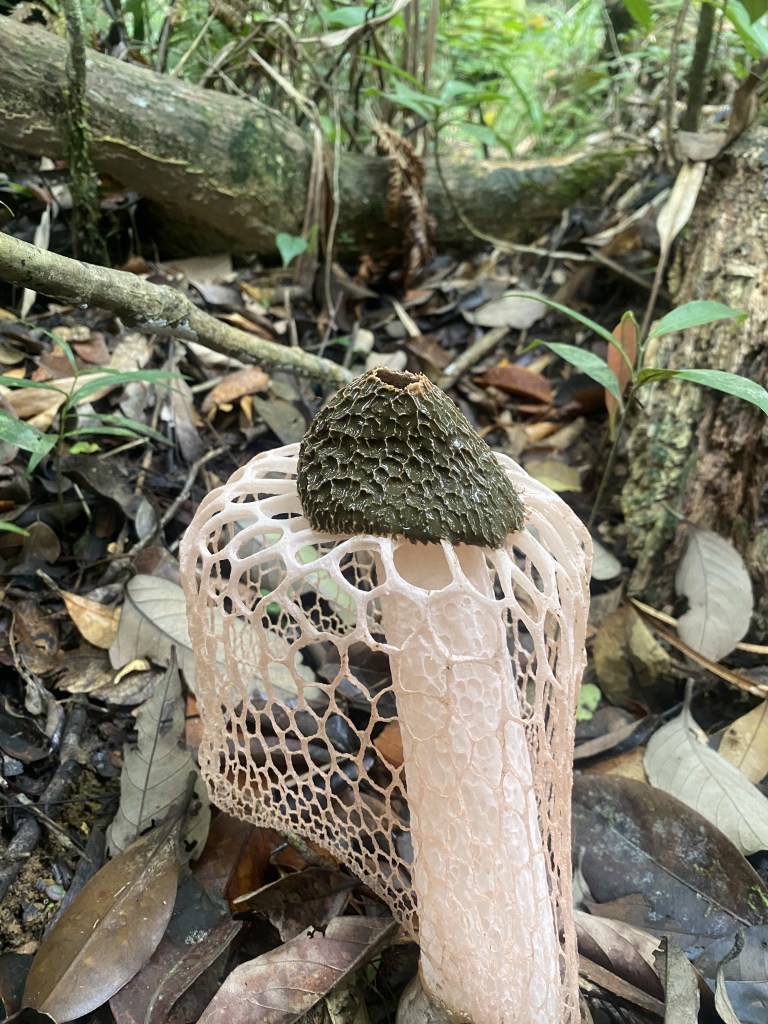
Descending on this hill was quite challenging because of the steepness of the trail as well as the overgrowth of plants. The trail was hard to see because of the plants! During the descend we got to see this fungus, a pink umbrella like fungus. I sent it to Karen later, and she found out the species it is called phallus indusiatus
We regroup on the trail, and proceeded off the trail. How I wish we followed the trail! It could much be easier if we followed the trail. No, we bushwhacked again for another time. Rexxa told us it was not this overgrown as last year. A local said that the trail we passed was not used anymore as the logging trail was much more easier.
Passed the overgrown trail was a trail filled with ferns again. While we were walking, Mang Boyet got stung by a bee. He ran back to us and prepared a twigs that burned, so as smoke would distract the bees. We did what Mang Boyet told us to do, and past the dead tree where the beehive was purportedly located.
Past the beehive we reached a river where we could get some rest, and refilled our water bottles. Checking his foot, Joep got a blister; he asked Rexxa if she had a gauze pad (?).
As a result that, Joep got disqualified on the challenge; Pagz, and Aiko were the ones who left.
We started to trek again after 15 minutes of trekking. Down the trail was reminiscent of Mt. Tapulao, rocky, slipper, and dangerous. The trail was also confusing because there were a lot of community trails which would lead to someone’s house or a waterfall. So, Mang Boyet set-up pink colored ribbons at the trail so that the sweepers could see the right way. The sweeper group after they past the trail would get the pink ribbon so as to use it on another day,
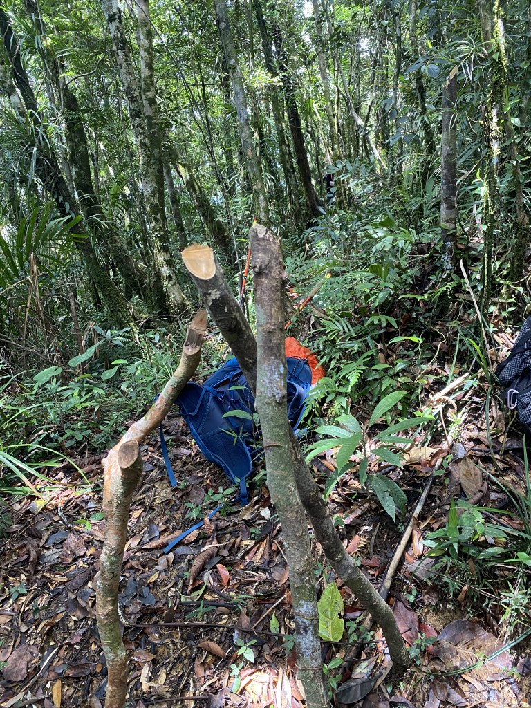
Pagz, and I, meanwhile, set up branches on the wrong paths.
After that difficult trail, we reached a large river which we believed to be from a falls we passed earlier. On the other side of the shore, you could see a hut, a roof of which consisted of a blue tarp used for tricycles.
We waited for the others to arrive. During this time, Pagz inquired on how Yabag had formed. Mang Boyet recalled that they were merely a group of hikers constantly doing reconnaissance for new trails, until they were constantly doing hikes together. From that point on, they formed Yabag.
Aiko, and the others came. She got a bruise on her lips because she slipped on the trail,
If I remember correctly, Bernice asked Mang Boyet how far was the camp site would take. Mang Boyet answered 20 minutes. Upon hearing this we got elated because of how long this hike was!
We started trekking, and the trail, once a forest full of ferns and red bark trees, turned into coconut trees. The proliferation of coconut trees is indicative that the beach was near, because coconuts love the sandy soil. After twenty minutes or so, we heard someone singing karaoke. We knew then that the Dimanayat campsite in San Luis, Aurora was near; we are correct. We reached the campsite at 5 PM way ahead of the past participants in PCT 2.
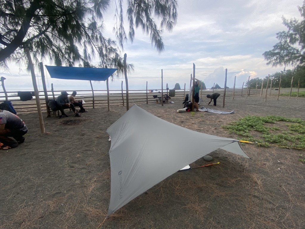
Our camp was near the sea; it was vast so vast that it could accommodate 100 people. Pine trees were also abundant in the campsite. There were also poles installed at the beach, perfect for those who used hammock as their sleeping system. The campsite was also home to some locals. Luckily, you could resupply here as there were two stores., but it is only limited to basic goods.
We set up our camp, took a bath, and cooked our dinner. A local, Kuya Jun, butchered two chickens, and made tinola, a Filipino stew with unripe papaya, and chili leaves.
The women camped behind us, while us men camped near the the fence.
When the tinola was ready, we ate our dinner. Kuya Jun, and his friend—- I forgot his name, my apologies—– accomdated us and drank some gin. He told stories that back in the day, they walk on foot to Dingalan to get some goods, and it was a two day walk, he said. Now, they rode on a boat to Dingalan which cut the travel time to eight hours.
The other man, promised us to make some smoked surgeon fish which were abundant there.
We called it a night at 10 o’clockl in the evening, and slept nicely, without any hard rain only the wind touching our tents, and hammocks. We got up at 6 o’clock in the morning because we would start our trek at 8 o’clock in the morning. Kuya Jun’s friend gave us smoked surgeon fish for us, how sweet he was! I took three of it, and gave it to my wife. It was tasty and not salty, my wife told me when I cooked it.
We packed our bags and took again a group pictures and headed to Labgan Campsite.
Day composed of walking on the beach front, like PCTs 1, and 3. However, the weather was hot, humid; even in the early hours in the morning, you could feel the humidity in your body. Not to mention that the beach front was quite long.
There were multiple stream crossings this day. We climbed a hill, whose trail was yet to be established. After which, we traversed a hill the downhill of which was quite steep. You need to crouch down in order not to fall. It continued like this until we reached a small stream where we regroup, and refilled our water bottles. We continued the trek until we arrived at a beach at 12 o’clock midday.
The house we stopped in had a store where you can buy cheese sticks, hotdogs. We had lunch at the house until 2 o’clock in the afternoon. At exactly the same time, we headed towards Labgan Campsite. The trail towards the hill was steep, not to mention the dark clouds signifying that it would rain. The trail in this hill was overgrowth despite locals passing it. In that, you need to check what you are stepping. Otherwise, you could fall off a cliff.
Past that overgrowth trail, we started to descend; we heard the thunder close by, and a flash of light up in the sky. Suddenly, rain was pouring on us, and the trail got muddy. One could slip should he/she was not careful in his or her footing. After 20 minutes, we reached the beach head. When the entire group arrived, we high five each other, and proceeded to walk the beachfront.
I love walking in the rain on a beach! It’s like a solemn experience walking while you hear the sound of rain, the droplets falling on you. At 5 o’clock in the afternoon, we reached Labgan Beach Front. The rain continued to pour in to the night; meanwhile, we started to unpack our sleep system. The women slept at the porch, while us slept on the garden, with a tarp on it. So drunk I was that night that I did not set-up my inflatable foam! Rather, I slept on my tyvek.
The rain stopped the next morning, and we were greeted with bright sunlight. We bid goodbye to our lovely host, and continued our journey to Sitio Dibayabay.

One thought on “Pacific Coast Trail – Phase 2 (5d4n)- Days 1 to 3”