Puerto Galera is a top destination here in the Philippines. It has pristine beaches, white sand, and the lively night life of the island. Puerto Galera is also the home of the Mangyan, the indigenous tribe of Mindoro province.
Puerto Galera Ultra has been one of my bucket list of ultra races here in the Philippines, since I have not gone to Puerto Galera, and I have not hiked the mountains in Mindoro. Well, Mt. Halcon, the highest mountain in the province, is the mountain that I wanted to climb, but it is closed as of this moment. No further announcements have been made on when it will be reopened.
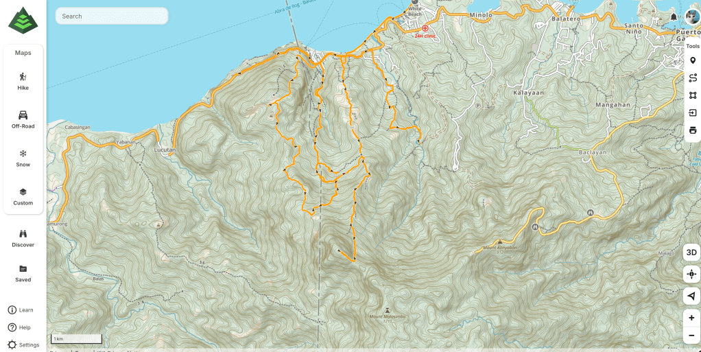
Puerto Galera has three mountains: Mt. Kubi, Mt. Matuko, and Mt. Malasimbo, the highest mountain in Puerto Galera. The race course was like a flower: You will go back to the same Aid Station, and hike on the same trail, save Aninuan Falls. Further, the trails around Puerto Galera were confusing, since the locals hiked the mountain and did work there. As such, the trails branched from different parts of the mountain. Caution must be taken here, as you could get lost.
Puerto Galera Ultra has a total elevation of 3,104 meters, and has a cut-off time of 17 hours. This elevation may look like an easy peasy run. However, the starting line is at sea level. Meaning, you will start from 0 meters up to 1,231m, the highest elevation in the race. One gets the impression that this race will be brutal. Indeed it was.
Christian, and Maui, my hike mates, were the ones that accompanied me in this run. Christian, after a break from ultra running, decided to join, while Maui, registered in this race, because she had not had hiked in Puerto Galera, and this race was her first ultra. She also organized the trip—–she was God send! We boarded a boat from Batangas at 12:30 in the afternoon, and we arrived at Puerto Galera at about 2:00. We directly went to the hotel we checked in, and dumped the contents of our bags. We decided to go out and eat. After a few hours wandering the place, we found this only one Japanese restaurant in Puerto. We ordered ramen because it was raining hard, and some dumplings. I ordered a shoyu ramen, and It was delicious!

We slept early, because the start of the race was 12MN on Saturday.
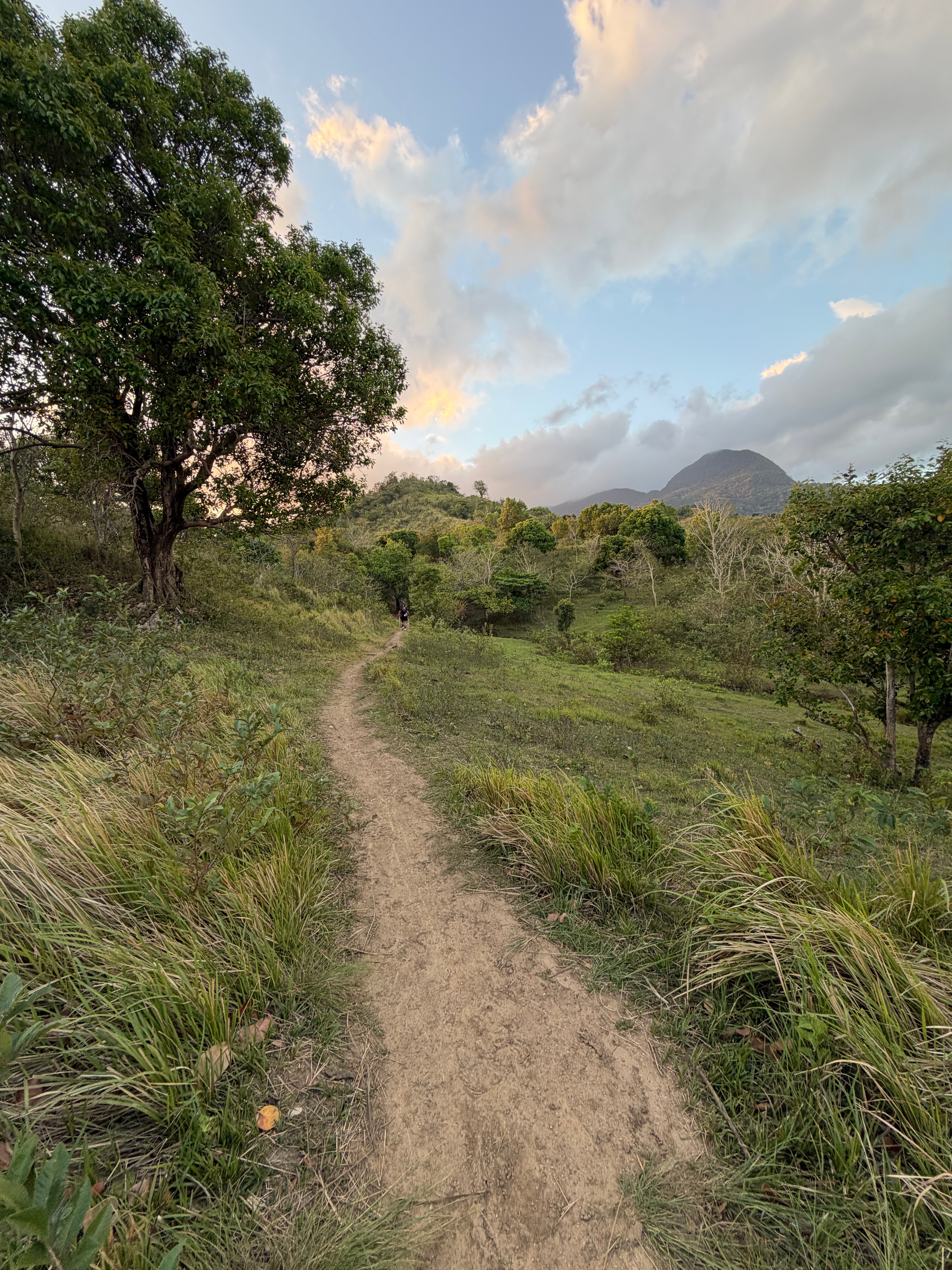
Nothing much has left to do the next day. We rested as much as we could so that we had energy left on gunstart; sleep did not come; so, we went to the racekit claiming, and the sea scintillating along the way. Familiar faces from other races joined the event, and the elites were there, too. Emman the Race Director told us we were only 38 runners from the 50KM category. The others were on the shorter distances. The night came, and we packed our packs, and mandatory kits; we headed towards the starting line, White Beach Resort. The unique thing about this race was that the starting line started at the beach, and we would run at the white sand of Puerto Galera. At midnight, March 15, the race started.
The three of us jog on the beach, while the onlookers cheered us. We headed out to the nearby rocks at the beach. I almost got injured because I misplaced my foot between the rocks. One runner remarked, “And aga-aga pa lang ng race, me maiinjure na.”
The first part of the race was Mt. Matuko in Talipanan, climbing up to Mt. Kubi, then going down Mt. Kubi’s trail. We first pass the only Aid Station in the course, and we headed to the first mountain. It was a beginner’s friendly mountain that had an elevation of 385+ MASL. Despite the low elevation, however, the path going to the mountain was very steep! I perched out my trekking poles early because of the steepness of the trail!
The steepness was not only the challenge in navigating this mountain, but also the fallen trees on the trail because of the recent typhoon. Mt. Matuko was not popular a hiking destination, compared to other mountains. On the slope I left the two. I was alone on the trail. I got part of the trail that was wet; so, the unwelcome critters appeared: limatiks, or forest leeches.
For some reason, Mindoro’s mountains was full of limatiks from Oriental Mindoro up to Occidental Mindoro. Mt. Halcon was worse: It was limatik haven.
Luckily, one or two of them attached to me, since I applied efficascent oil before the race. Mountaineers swore on efficascent oil, and other eucalyptus smelling products on the effectiveness of them.
Then the trail transitioned from forest to coconut plantations. Mangyans lived in mountainous parts of Mindoro, mostly away from Tagalogs. That was why there was a coconut plantation there. Good thing trail markers are well marked because the trail was confusing that you could exit in some part of the trail. Passing the coconut plantation, I entered another overgrown forest. Luckily, the overgrown forest was a ten minutes traverse. Now, the trail was easily seen. Pushing to the summit, I passed two runners on the way; after an hour or two, I reached it.
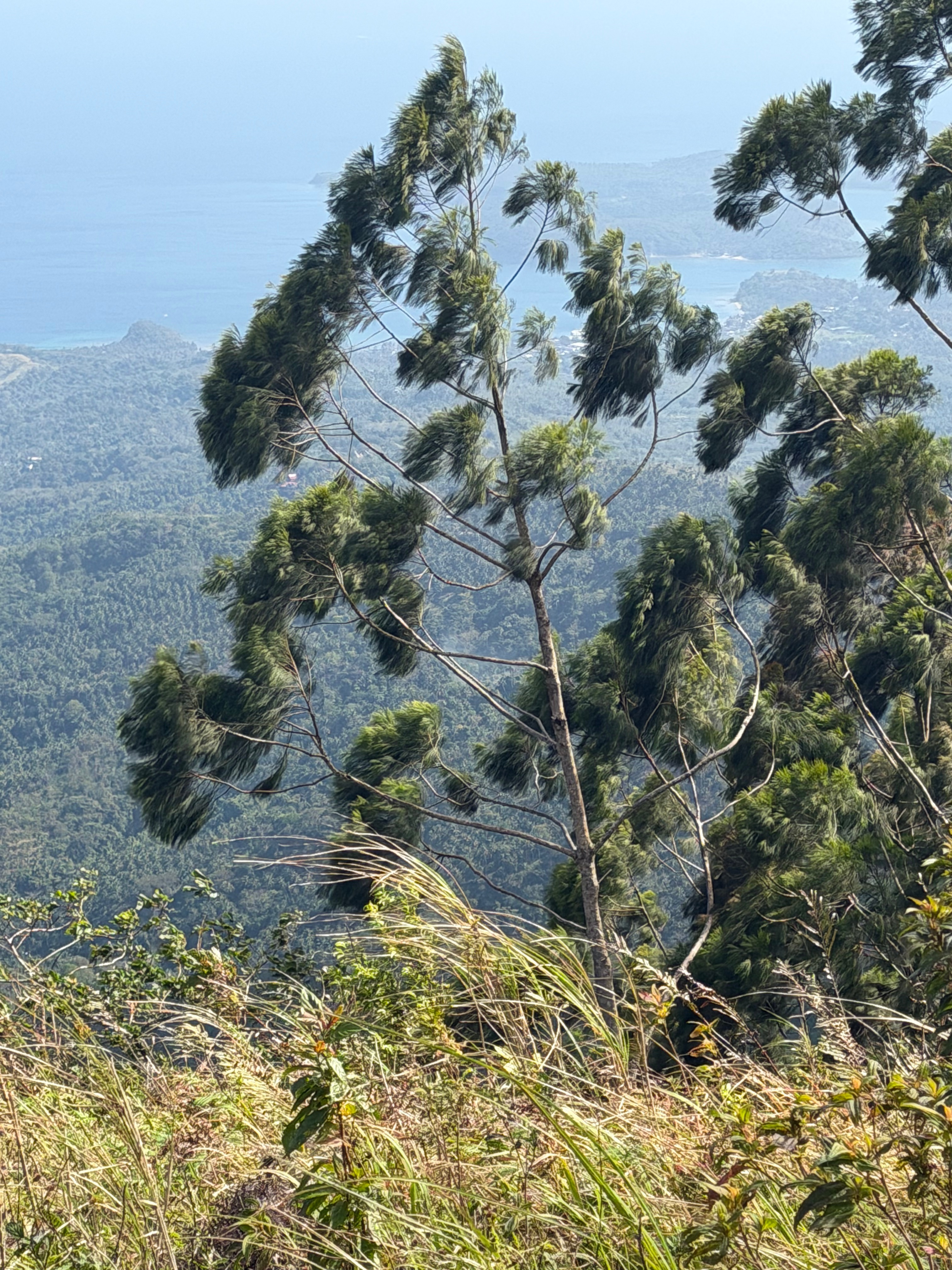
The summit was teeming with talahib; on the edge, one will see a Mindoro Pine, swaying on Mt. Maluku’s windy summit. Mindoro Pine were a native species of pine that is only found in Mindoro. They are beautiful to look at. Too bad it was still dark; I could not see the beauty of them. The trail was runnable, but even so, the trail forked, and I got confused. When I noticed that I did not see any trail signs, I looked on my phone; viola, I got off track for 400 meters! Getting lost was part of trail running, lol!
Now, going to Mt. Kubi. It had the same talahib summit of Mt. Matuko. I did not know if Mt. Matuko overlooked the other mountains in Mindoro, as I did not return to it.
As I traversed to Mt. Kubi, I suddenly saw my light flickered. I thought it was a mere branch interfering with my light. So I brushed it off. The light of my headlamp flickered. It was not a branch; my headlamp had not properly charged! On the hotel, I recharged my headlamp on my power bank. There was a light indicator on its battery, telling you that it had been fully charged. Unwittingly, I removed the usb cord connecting the battery, thinking that since there was no light in the light indicator. Petzl’s battery turned to green when it was fully charged.
Seeing this, I lowered the settings of my headlamp, so as to save batteries.
The descend to Mt. Kubi was difficult: The trail was steep, slippery, and sandy; one wrong move, and you would tumble down to the bottom of t he ravine.
I jog the descent to save my legs from the race. Finally, I got to another coconut plantation. I stopped because I got hungry, took my Cloud 9, and ate the chocolate bar. While eating, I saw two runners coming to me: They were Christian, and Maui!
I told them that I got lost, and my headlamp almost lost its batteries. In light of my bad luck, I teamed up with them. After a few minutes, we arrived at Mangyan Village; eventually, we arrived at the Aid Station.
After five minutes eating kakanin, we headed out to Aninuan Falls. The whole trek lasted for four hours for 10km.
Aninuan Falls was more on road section. More so, it was situated near the Japanese restaurant we ate last Friday. However, we would trek the old trail which comprises of gentle uphill, coconut plantations, and limestones. I curse this part, as I often fell from the hole that was used to dispose the coconut husks, and the slippery limestones along the trail. I blamed myself because I did not properly charge my phone.
With that said, after the race, I bought another Petzl headlamp in case my other one was not charged.
We arrived at the guy who timed the arrival of runners in Aninuan Falls. Daylight broke, finally, and we hurried towards the Aid Station.
Next was Mt. Malasimbo.
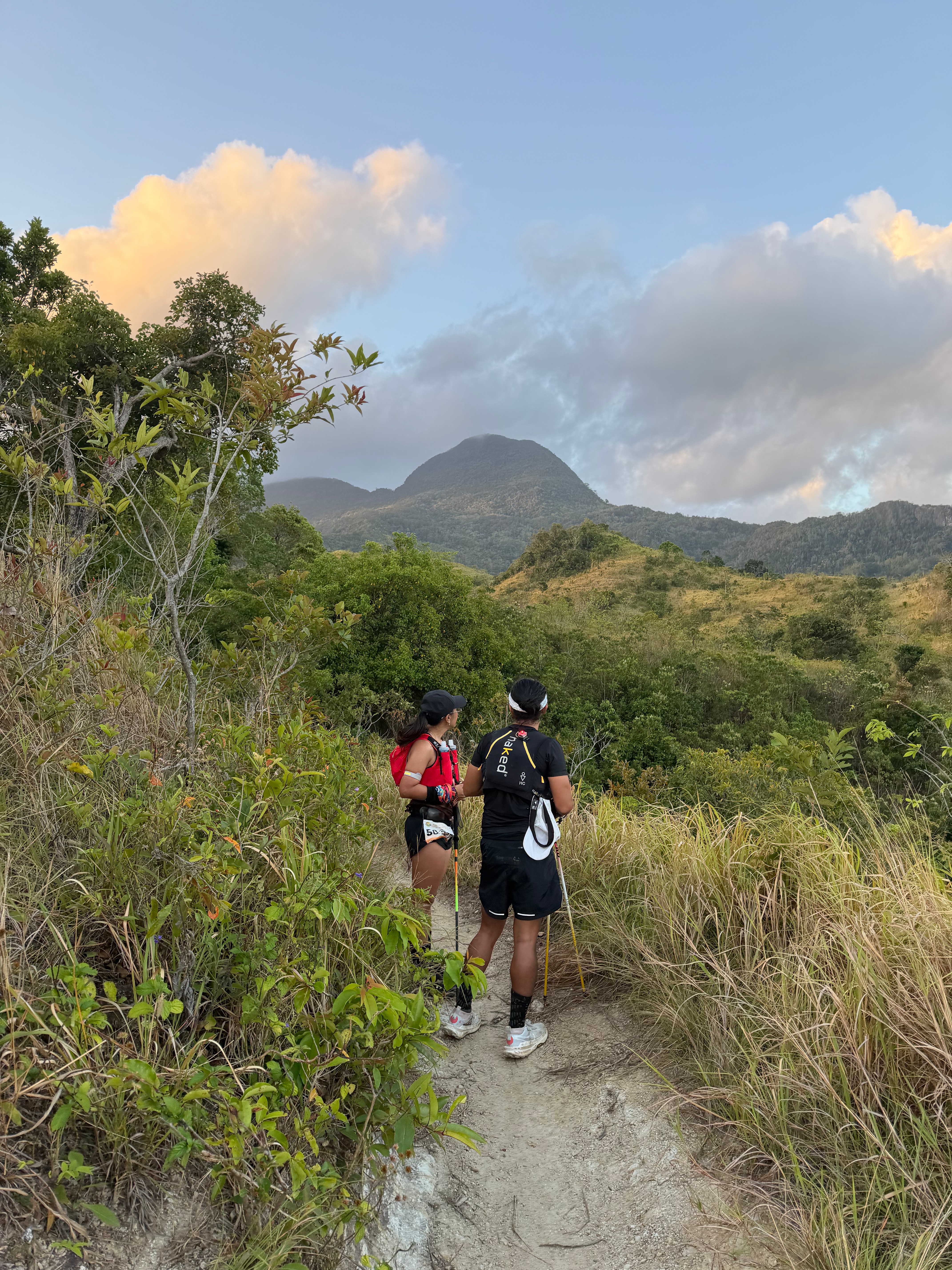
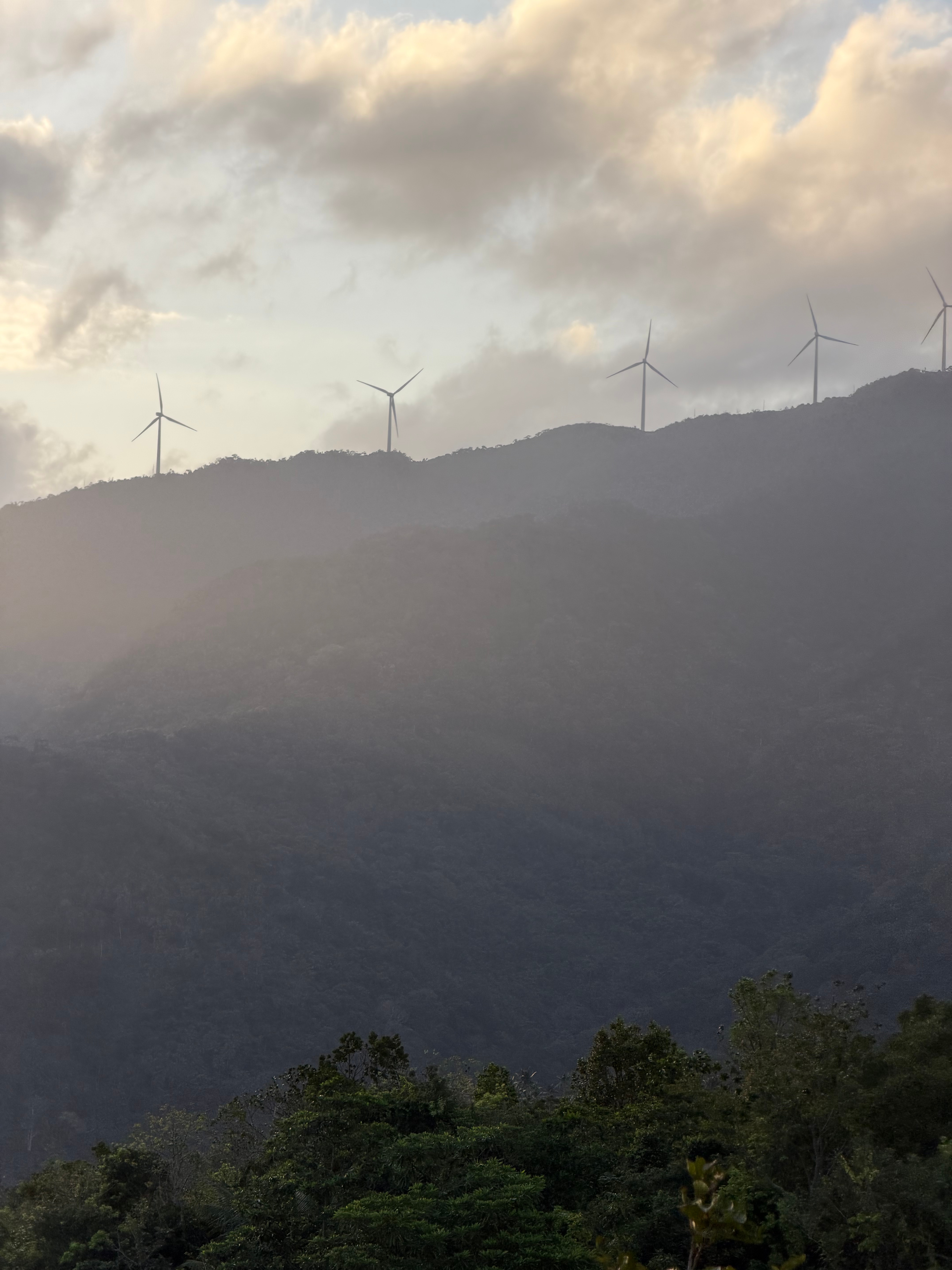
We started at the Mangyan village; the trail leading to Guijo Campsite was upwards. We caught our breaths; as we soon reached Guijo Campsite, the view was awe-inspiring: One could see the ocean, and Verde Island. On the west, one would saw the windmills of Puerto Galera perched up the ridges. There was a water source along the trail—-the only water source, and the other side was flat; so, you could set-up camp here. On the north was Mt. Malasimbo, its dome shaped summit towering all over Puerto Galera; it is breathtaking to see.
Past Guijo Campsite was the undulating talahib grass swaying on the wind. If this was not a race, I would stop and take pictures on the trail! On the edge of the cliff there was an abundance of Mindoro Pines. They had no scales (?) unlike the Benguet Pines.

After a half an hour or so, we entered the forest. Entering the forest meant one thing: We entered the kingdom of limatiks. The rain did not help either, limatiks are abundant when raining. At least ten attached to my leg, thank you for my blood type, for having an affinity with blood sucking insects, and limatiks. The good thing was that there were no green striped limatiks. Only those brown ones that bit at your legs.
The trail was so technical here that running was impossible. We reached a trail filled with rocks. It was slippery! All the things here were slippery including the rocks!
Past the the rocky trail was the continuous assault towards the summit. The trail was windy and wet; it was reminiscent of Mt. Tukduang Banoi, a mountain which I climbed on 2025, during Sta. Ines Mountain Run—-review would come soon. I overtook two runners who were catching their breaths. Caution must be exercised here because one would tumble down the cliff, should he lose grip or slipped on the slippery roots.
At this point, the mosses got bigger, and the wind got colder. We entered the mossy forest; soon as we came to the flat portion, pandanus trees towered the trail, it littered the trail with its long and serrated leaves.
Few minutes of trekking we reached the summit. The summit was akin to Sierra Madre mountains. The view was unremarkable at the summit; a Mangyan marshall waiting at a bonfire marked our bib numbers, and as soon as all our bib were marked, we descended. Christian, and Maui descended fast because they needed to overtake the lady runner, who I had surmised, was the number three on women’s category.
I, on the other hand, savored the view of the mountain. God, I appreciated the trail of this mountain; it was like going to Sta. Ines once again. The thrill of the slippery roots, and rocks, the limatiks attaching to you as though it was requesting your sweet, sweet blood, the fog, and mossy forest, these are the ones that I truly enjoy in this course.
Returning to the grassland, I finger hearted the mountain signifying thanks to the trail.
I got back to Guijo Campsite; other runners were yet to climb Mt. Malasimbo. Soon, I got to the Mangyan village at the trail. The children playing were saying good morning, and I returned their good mornings to them. I returned to the Aid Station at or about 10 in the morning.
Next mountain was Mt. Kubi again.
The sun was high, and you could feel the heat of the road radiating to your face. Luckily, it was windy today. I passed again to the Mangyan Village at Mt. Kubi. This time, the villagers were doing their everyday activities: some, playing basketball, while others were selling their handwoven handicrafts. One seller, offered me her craft, but I declined, saying to her that I currently was on the race.
The trail here, during daytime, was very confusing. I got lost three times. Thanks to the local who pointed the way going to the summit, I would be lost multiple times! I returned to the Aid Station at 2:20 in the afternoon, after one hour of getting lost. The last segment of this race was going the border between Puerto Galera, and Abra de Ilog. One must take a selfie in the signage of the military, and send it to the Emman for evidence that you reached the area. The road was uphill, and it was the middle of the day, so it will be a difficult run. The views were eye candy, though. At your left, you will see the unnamed hills of Abra de Ilog. On your right side, you will see the emerald green vastness of the sea.
Luckily, I managed to run the segment for one hour, despite the heat.
There was an hour to go, and I rushed to the beach where the race started; after 20 minutes, I finished the race. I was the last sixth participant to finish the race, and only 19 were able to finish Puerto Galera Ultra.
The race was tough, but rewarding. Rewarding to views, to the locals, and most importantly to the terrain where you run. It was unique in the sense that there was this kind of lush vegetation despite nearing a popular beach destination. I am glad that I participated in this race.
